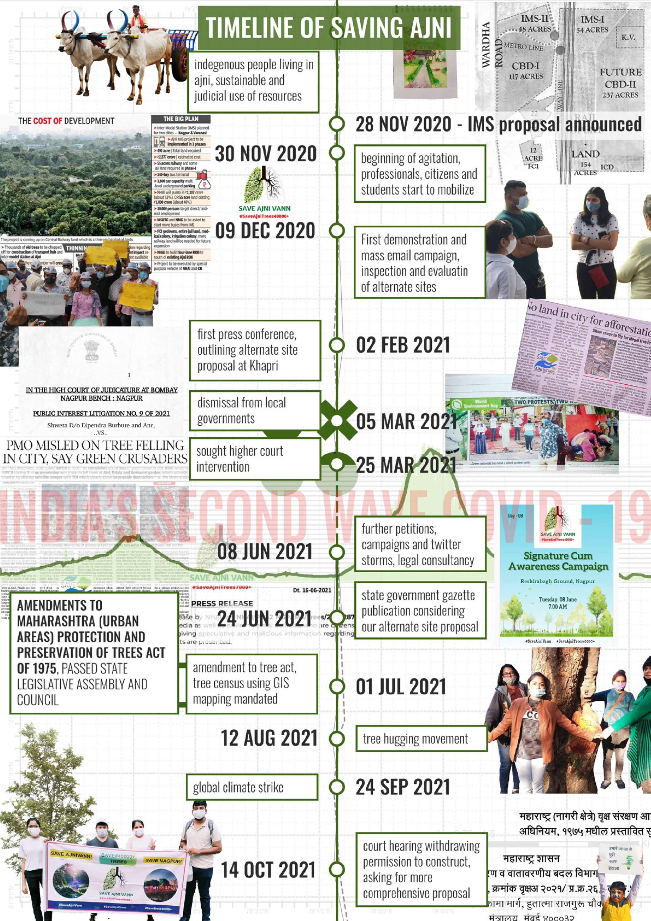
Project Brief
In 2021, the government of Maharashtra proposed the construction of a disruptive 500-acre intermodal station, one that would destroy over 40,000 trees, 20 housing quarters, and have catastrophic health implications on nearby residents. Citizen groups led by advocates, architects and planners were quick to mobilize and protest this mass deforestation while also developing an alternate site proposal, one that does not require massive felling of trees, is better connected to the transit network and would not lead to evictions and displacement of residents.
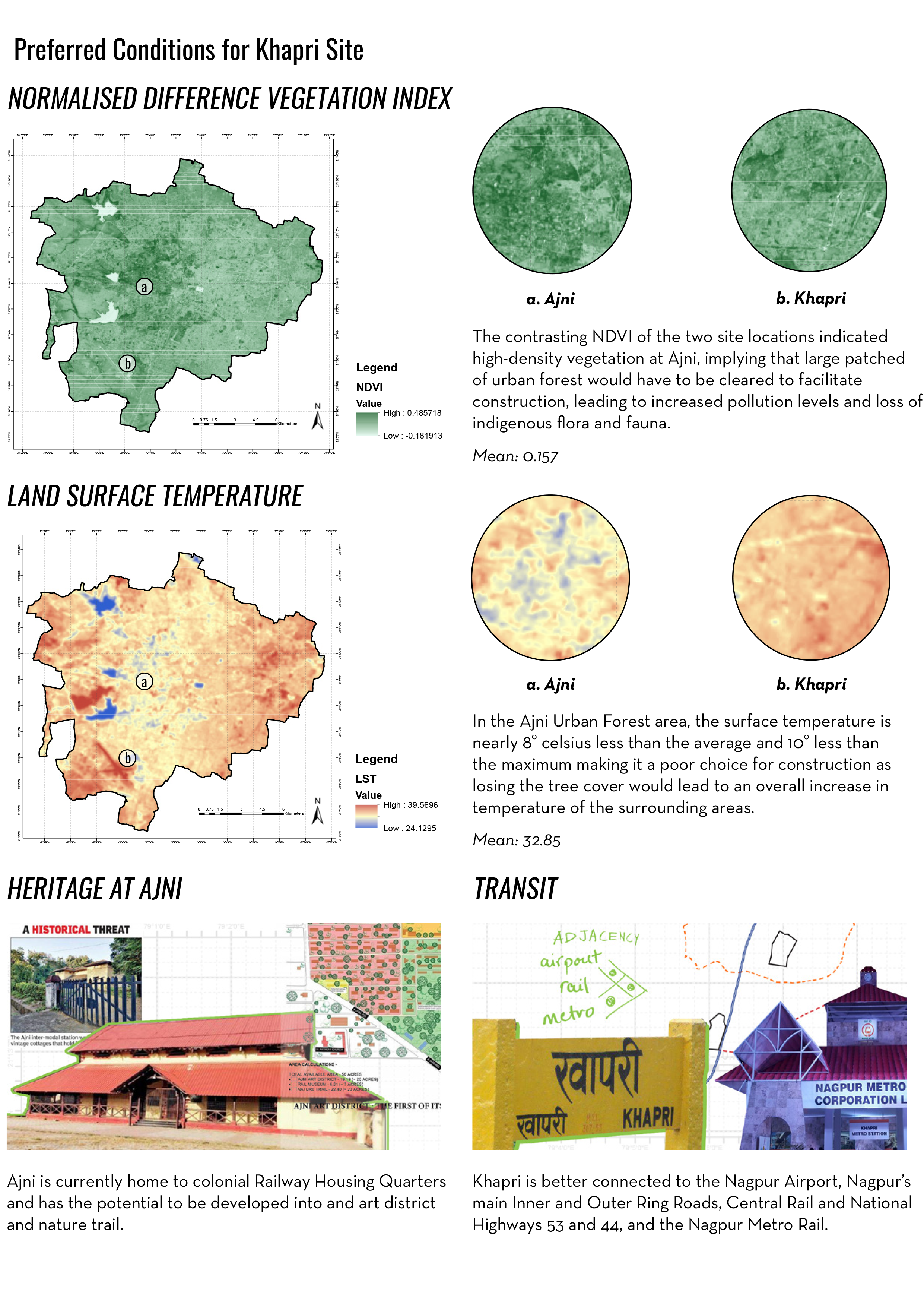
My team and I worked on the site proposal using predictive spatial analysis using raster data (Landsat), Google Earth Engine and remote sensing in ArcGIS and Python.
Using our analysis we were able to justify the alternate site and facilitate sustainable and equitable urban development.
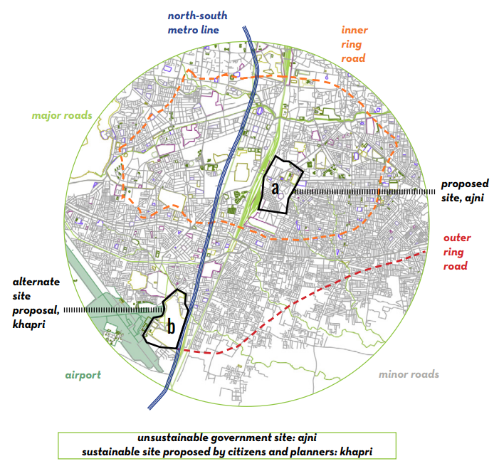
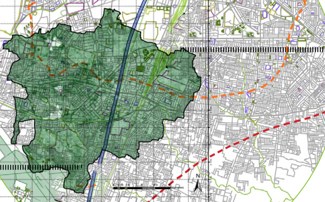
This map illustrates two proposals for the site of construction for an Inter Modal Station. The original proposal at Ajni was administered through a top-down approach by the state government. Citizens were alerted of the mass deforestation the project would cause and raised their concerns to me and my team. The alternative site proposal at Khapri was derived through public participation, taking interdisciplinary inputs and validating our suggestions through on-ground research and spatial analyses.
After facing initial dismissal by local authorities, in late 2021, a gazette publication by the state government considered our alternate site proposal, effectively halting construction.